Environmental 3D Visualization
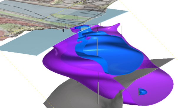
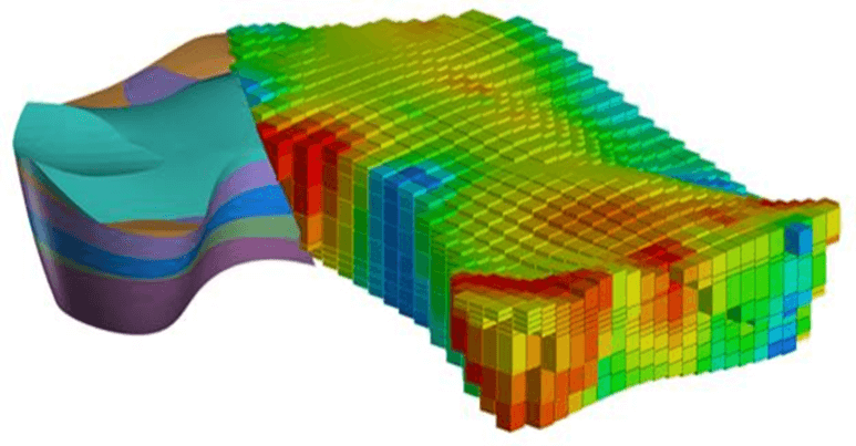
Environmental projects generate a large amount of data. Comprehension and evaluation of these data are critical components of a project’s technical and economic success. Three-dimensional visualization and analysis (3DVA) of environmental data sets is an invaluable aid in the evaluation and comprehension of site data for environmental assessment, groundwater modeling, and remedial design.
Environmental Standards leverages the capabilities of the best 3DVA tools to accelerate project closure and add value for clients. Data evaluation with these tools is quicker, less costly, and more powerful than using traditional techniques.
3DVA Benefits
- Analyze site history quickly and completely
- Identify data gaps
- Drive project planning and development of remedial strategies
- Create powerful, effective presentations and animations
- Streamline development of subsurface conceptual models
- Reduce decision risk
- Reduce long-term project costs
- Support consensus-building and collaborative problem solving
- Optimize sampling locations and excavation areas
- Visualize and quantify impacts of treatment systems/remedial actions

Applications of 3DVA
Assimilate
…historical data of multiple types to gain site understanding quickly
Synthesize
…complex data sets enabling efficient, timely remediation decisions
Interpolate
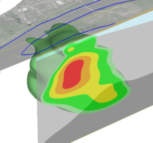
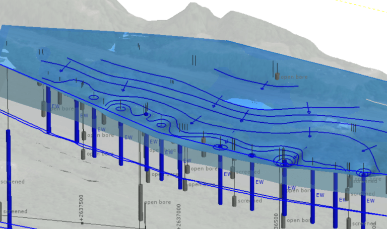
…contaminant plumes, piezometric heads, and hydrology
Visualize
…and animate groundwater flow and contaminant migration pathways
Uncover
…correlations between contamination and hydrogeology
Drive
…high-value collaboration sessions among experts, managers, and clients
Present
…live 3D models to enable informed decisions related to characterization, fate and transport, and remediation
Reveal
…complex hydrobiogeochemical relationships that have escaped understanding
ACCELERATE
…project closure with quicker data evaluation- and better identification of risk and data gaps.
Quantify
…uncertainty of contaminant interpolations
Run
…geostatistical analyses
Increase Accuracy
…and precision of subsurface contaminant volume and mass estimates
Seamlessly Integrate
…with groundwater flow modeling
Design
…and visualize soil and groundwater remedies and excavation plans
Communicate
…with narrated animations showing models being manipulated to tell the winning story
Convince
…regulators, clients, and the public that your conceptual site model is correct and that your proposed solution is the right one.
3DVA Software
Environmental Standards’ 3DVA Specialists have expert-level proficiency in sophisticated environmental visualization tools including Leapfrog Hydro® and Earth Volumetric Studio®.
These tools are capable of assimilating data sets in 3D from a wide variety of sources including:
- Water, soil, and air quality data
- Site maps (AutoCAD®, geographic information system [GIS] layers)
- Aerial photography
- Satellite and remote sensing images
- Downhole stratigraphic, lithologic, and geophysical data
- Topography
- Cross sections
- Scanned hard-copy historical graphics.

Live 3D Models
Live 3D models may be exported and sent to clients and stakeholders decision-makers for use with free viewer software. Preset slide views and animations can be developed to communicate site processes. The models may be extensively manipulated by clients decision-makers within the viewer software.
Users can pan, zoom, rotate, slice the 3D model, adjust layer visibility, and interrogate the model by clicking on features to reveal attributes such as building names, surfaces areas, and plume volumes.
3DVA software features tools to support collaboration. Clients are able to perform data quality assurance/quality control (QA/QC), audition model views for presentations or deliverables, and provide feedback for model refinement, which can easily be shared with Environmental Standards for finalization. Additional visualization tools may be utilized depending on project needs including ArcGIS® (ArcScene), Surfer®, SketchUp®, Google Earth Pro®, and others. Environmental Standards leverages the best features of each tool for every 3DVA solution


Advantages for Project Management
3DVA not only helps with data evaluation, but also helps bridge the gaps among consultants, clients, regulators, and the public by presenting easy-to-understand visualizations of complex site processes and treatment/cleanup plans. Vivid 3D graphics and animations convey critical information in easy-to-understand terms.
3D models developed using the latest 3DVA tools can serve as a 3D database repository for site data. By looking at all site data visually in one place, users will easily identify data gaps and reveal problems.
A well-developed 3D model allows Project Teams to build confidence that site conditions are well understood. This confidence generates cost savings and efficiencies throughout the project life-cycle.
3DVA tools enable increased accuracy and precision of subsurface contaminant volume and mass estimates over traditional methods, leading to cost savings in the remedial design phase due to reduced excavation footprints, fewer installed monitoring wells and soil borings, and application of appropriate remedial technologies.
Data Management + 3DVA: A Winning Combination
Combining 3DVA with Environmental Standards’ existing Information Technologies Solutions helps clients reduce costs even further while adding value to their projects. Reducing and formatting data sets of poor quality can be a significant labor component of some 3DVA projects.
If clients are already using Environmental Standards for their data management needs, they should be confident in their data quality; so it may make sense to enhance their projects with 3DVA services to leverage the full power of the existing database. 3DVA services can easily be tailored to project requirements and budgets, no matter how large or small.


